What: This webinar organized by the H2020 WeObserve project, is aiming to present success stories where citizen science data are combined with conventional sources of Earth Observation data. Focus will be given to showcase best practices arising from the activities of H2020 Citizen Observatories (LandSense, GROW, GroundTruth 2.0, SCENT) and from other projects as well, while illustrating how the integration of Earth Observation and citizen science can improve environmental monitoring. Moreover, a discussion with the responsible of the Copernicus in-situ component will take place towards the selection of a pilot to illustrate the potential of citizen-science as contributor to Copernicus.
Why: Traditional environmental monitoring systems such as Copernicus, produces a variety of valuable datasets relevant to environemtal monitoring (i.e. land-cover/use, atmospheric emissions, ocean water quality, etc). This data is meticulous and offered for the entire EU landscape, however its update rate is scarce due to increased costs and timely data validation procedures.
Citizens’ observations, data and information can complement these official, traditional in-situ and remote sensing data sources, allowing relevant authorities to improve and fill gaps in the environmental monitoring process.
Who (is the webinar for): Earth observation experts, citizen-science actors, researchers, software engineers, solutions providers, policy officers and other non-technical audience that want to be engaged with novel approaches and applications for environmental monitoring, harnessing both earth observation and citizen-sourced data.
About Your Presenters
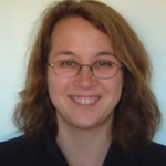
Linda See has been a Research Scholar in Ecosystems Services and Management of the International Institute for Applied Systems Analysis (IIASA) since October 2010. Prior to IIASA, she was a Senior Lecturer in Computational Geography and GIS in the School of Geography, University of Leeds for 11 years. Dr. See’s research interests include artificial intelligence-based methods, geographic information systems (GIS), land cover, crowdsourcing and citizen science. She is an active member of the Geo-Wiki team and has worked on a number of crowdsourcing aspects including quality issues, community building, and a branch of Geo-Wiki concerned with validation of urban land cover.

Linda See
Senior Research Scholar, International Institute for Applied Systems Analysis
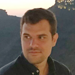
Valantis Tsiakos is working as a Researcher & Scientific Project Manager, member of the Smart Integrated Systems & Communication Team of the I-SENSE group of the Institute of Communication and Computer Systems. His studies focus on Urban Planning and Regional Development (University of Thessaly), Geoinformatics and Earth Observation (Harokopio University of Athens). He has been involved in various EU funded projects, emphasizing on the application of information systems in the environmental sector. His scientific interests include: spatial data infrastructures, remote sensing, image processing, standardization, environmental applications, citizen science and crowdsourcing.

Valantis Tsiakos
Scientific Project Manager, Institute of Communication and
Computer Systems
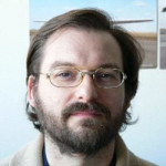
Joan Maso is a principal investigator of CREAF in the interoperability, quality and certifications tasks. (PhD in Geography, MSc in Physics, and a MSc in Electronic Engineering all in the UAB). Since 1995 he is a researcher at CREAF and GIS developer. Co-creator of the MiraMon compressed map and the MiraMon Map Reader idea in 1997; the first MiraMon technology for Internet distribution. Creator of Remote Sensing imagery visualization and download web data portals. Active member of the TC of the Open Geospatial Consortium (OGC) since 2003 (editor OGC 07- 057r7 WMTS standard and chair of the Iberian and Latin American Forum). Spanish representative in the TC 211 and editor of the ISO 19165 Preservation of geospatial data and metadata. OGC Gardels gold medal. Involvement in various EU funded projects (GeoViQua FP7 project, H2020 ConnectinGeo, H2020 ECOPOTENTIAL, H2020 GroundTruth 2.0, H2020 WeObserve H2020 ERA-PLANET, H2020 E-Shape, H2020 BestMap, H2020 COS4Cloud, ESA-IHE Phenotandem) Chair of the OWS Common and member of the OGC Architecture Board. Senior member of IEEE and council member of the International Society of Digital Earth.

Joan Maso
Scientist, Ecological and Forestry Applications Research Centre
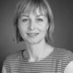
Mel Woods is Reader at DJCAD, University of Dundee. She has over 20 years experience in collaborative and interdisciplinary research with expertise in Design and Interaction. Mel has developed and explored interaction between people to support discovery, foster creativity and affect. Throughout her academic career she has sustained a critical enquiry in art and design, creating digital artifacts, prototypes and exhibits using novel methods and evaluation techniques. Mel has extensive experience leading interdisciplinary teams across art, design, computer science (Artificial Intelligence, Open Data and Semantic Web) HCI and ethnography, and regularly works with external agencies, businesses and communities. She has worked with NESTA and The Cultural Enterprise Office as a mentor for entrepreneurs in the creative industries.

Mel Woods
Reader in Creative Intelligence, University of Dundee
