What: This webinar organised by the H2020 WeObserve project, will introduce the story of EU’s richest citizen generated environmental datasets, spanning four Citizens’ Observatory projects: LandSense, GROW, GroundTruth 2.0 and SCENT. Citizen Observatories are a series of projects where people across the world come together to monitor how their local areas and the planet are changing. These projects have engaged tens of thousands of “citizen scientists” who assisted in gathering data at unprecedented scale for environmental dimensions relevant to their local area, such as air and water quality, wildlife, land cover and soil.
Why: The WeObserve team has launched an Open Data Challenge (ODC) and this webinar is an opportunity for you to discover what these citizen-generated datasets are all about, and ask any questions to the expert mentors who will be supporting participants throughout the ODC process. The ODC is a competitive online event and tender for participating individuals/teams to innovate using open environmental data from Citizen Observatories. Get a head start on winning one of the two €5,000 tender awards that will go to selected entries!
Who (is the webinar for): Earth observation experts, citizen-scientists, researchers, software engineers, solutions providers, and other interested audiences that want to find out more about WeObserve open datasets, and explore ideas to take part in the Open Data Challenge to solve the following social and environmental themes:
- Ecosystem monitoring: Phenology, biodiversity and land cover;
- Public infrastructure management – Soil Moisture and Drainage, Flood Mapping;
- Community-Based Disaster Management: Flood, Fire, Drought, Heatwave Services, Landslide;
- Regenerative food growing: yields, sustainable practices and natural pest control;
- Pollution monitoring and health: Water quality, air quality;
- Engaging young people on open data and climate: Education;
- Other: Innovative applications of WeObserve data e.g. COVID19
About Your Presenters
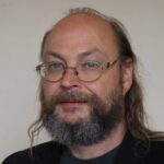
I am an expert in big data storage and analyses, with an emphasis on noSQL databases especially apache Cassandra, for which I have contributed code fixes to the project. I am the program lead for both Data Science and Data Science and Engineering MSc programs, which attract funding from the Data Lab in Scotland. These programs have seen more than 300 students graduate since 2010. I have developed a MOOC for FutureLearn “Data Science for the Games Industry” which has had two successful runs and is planned to run another 4 times this year.
I was a co-investigator on the successful GROW project and also the WeObserve project.

Andy Cobley
Senior Lecturer, University of Dundee, School of Science & Engineering
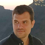
Valantis Tsiakos is working as a Researcher & Scientific Project Manager, member of the Smart Integrated Systems & Communication Team of the I-SENSE group of the Institute of Communication and Computer Systems. His studies focus on Urban Planning and Regional Development (University of Thessaly), Geoinformatics and Earth Observation (Harokopio University of Athens). He has been involved in various EU funded projects, emphasizing on the application of information systems in the environmental sector. His scientific interests include: spatial data infrastructures, remote sensing, image processing, standardization, environmental applications, citizen science and crowdsourcing.

Valantis Tsiakos
Scientific Project Manager, Institute of Communication and
Computer Systems
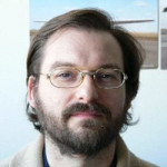
Joan Maso is a principal investigator of CREAF in the interoperability, quality and certifications tasks. (PhD in Geography, MSc in Physics, and a MSc in Electronic Engineering all in the UAB). Since 1995 he is a researcher at CREAF and GIS developer. Co-creator of the MiraMon compressed map and the MiraMon Map Reader idea in 1997; the first MiraMon technology for Internet distribution. Creator of Remote Sensing imagery visualization and download web data portals. Active member of the TC of the Open Geospatial Consortium (OGC) since 2003 (editor OGC 07- 057r7 WMTS standard and chair of the Iberian and Latin American Forum). Spanish representative in the TC 211 and editor of the ISO 19165 Preservation of geospatial data and metadata. OGC Gardels gold medal. Involvement in various EU funded projects (GeoViQua FP7 project, H2020 ConnectinGeo, H2020 ECOPOTENTIAL, H2020 GroundTruth 2.0, H2020 WeObserve H2020 ERA-PLANET, H2020 E-Shape, H2020 BestMap, H2020 COS4Cloud, ESA-IHE Phenotandem) Chair of the OWS Common and member of the OGC Architecture Board. Senior member of IEEE and council member of the International Society of Digital Earth.

Joan Maso
Scientist, Ecological and Forestry Applications Research Centre
